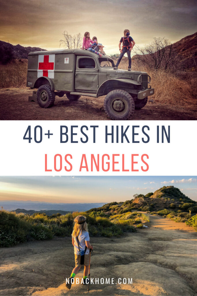
Would you ever have guessed that hiking in Los Angeles is *the* thing to do here? We were so surprised to learn this when we moved here 9 years ago.
Traffic, yes.
Celebrities, of course.
But hiking? Yes! it is really one of the most popular activities you will find Angelenos participating in all days of the week, and all times of the year.
The truth is, there are a TON of amazing hikes in the Los Angeles area, that it can take years to experience them all. When we first moved to LA, my son was only 3 so we didn’t do a ton of difficult hikes at that time, focusing on the best hikes for toddlers, but as the years have progressed, we have added more and more to our arsenal.
In 2021, we started the year with a goal of hiking (and biking!) 100 miles for the month of January and 1000 for the year. For our own purposes to keep track of the hikes we have done and would recommend, we started this guide on all the hiking trails in Los Angeles that we have been on or have on our list!
We will cover the best hikes in LA (according to popular consensus), waterfall hikes in Los Angeles as well as some great hiking near Los Angeles. Read on for more information for each. Check back often for updates as well.
Jump to a Heading Below
Ultimate Guide to Hiking in Los Angeles
In our effort to explore as many hiking trails in Los Angeles as we can, we have put together this list of hikes we have completed and ones we hope to do. We highly recommend using an app like AllTrails to read up on each hike to find out the latest conditions, how steep or difficult others have found the hike as well as to route your hike along the way.
We also recommend you always carry plenty of water, snacks, jacket and phone chargers while out hiking. Phone batteries die quickly while using GPS apps as well as when you take a lot of photos. There is nothing worse than being on a hike relying on your phone maps to have it die!
Furthermore, we highly recommend using a tracking app like Strava if you want to keep track of all the miles you are racking up and what trails you have completed.
Best Hikes in LA (aka Popular Hikes)
 We will start off with what many deem the best hikes in LA. These are the ones you would take visitors on, would do as a visitor and offer something special about this city.
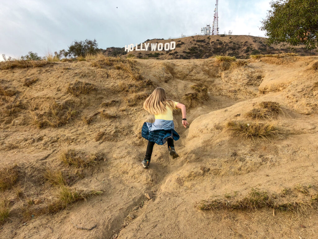
Hollywood Sign Hike
There are several ways to get to the Hollywood Sign on Mount Lee. Some are easier than others, but the traditional route starts from the Griffith Park Observatory parking lot leading up through Griffith Park. Other trailheads include the Brush Canyon Trail (6.4 miles, 1050 feet of elevation gain), Hollyridge Trail (3.5 miles, 750 feet of elevation gain) and Innsdale Drive (4.6 miles with 750 feet of elevation gain through neighborhood).
Runyon Canyon
While I am not necessarily a huge fan of Runyon Canyon, this is undoubtedly one of the most popular hiking trails in Los Angeles. It is a 3 mile out and back trail that is home to many of the Hollywood Stars which is what makes this trail popular for visitors. Not an easy hike, or particularly a nature hike by any stretch of the imagination, this uphill climb offers the chance to see Hollywood Stars in the flesh while hiking in the Hollywood Hills. Keep your eyes open as you huff and puff up!
Bridge To Nowhere
One of our the best hikes in LA is Bridge to Nowhere. This 10 mile round trip hike is located in the Angeles Forest and has multiple river crossings and even a bungee jump at the bridge! This hike is very popular when it’s warm out as the river crossings can also be used as swimming holes. In the winter be cautious as the water levels can be quite high. Trailhead address: Camp Bonita Rd, La Verne, CA 91750. The trailhead starts at the end of the road and you will need an adventure pass to park in the lot.
Solstice Canyon
Another uber popular trail is Solstice Canyon in Malibu. My recommendation is to avoid this popular LA hiking trail on the weekends as it’s always packed then. With a 3 mile loop and a gradual climb this is a decent hike for all ages. Start off on pavement and then make your way to the wide trail that follows alongside a creek. Stay to the left at the bridge and start heading uphill. Along the way you will see a burnt out home and other remains from former fires. At the fork in the road, take a left for the remains and the waterfall or head right to continue on the trail to meet up with the Rising Sun Trail.
Rustic Canyon to Murphy Ranch Park
This is a relatively famous hike because it was an encampment built by Naxi sympathizers during World War II. Now it’s a 3 mile loop trail with concrete remains covered in graffiti. To get to the hike you will either need to hike up or down over 500 stairs. To reach the hike, head to the Pacific Palisades, once you reach the yellow gate you can continue on by foot. You will take the stairs through a hole in the fence where you walk down the 529 stairs ending in a dirt path. After exploring, take the stairs to the paved road and take a left. At the fork, take a right to pass a water tower and pass through a hole in the stone to get back to the main paved road. It sounds confusing, but you will surely see other people and your AllTrails will also show the way. Not quite a nature hike, but an interesting hike nevertheless. Address for your GPS: 1562 Casale Rd., Pacific Palisades 90272
Temescal Canyon Hike
Easy Hiking Trails in Los Angeles
In addition to the 5 easy hikes for toddlers we have posted about, here are a few additional hikes that you can add to the relatively easy list.
Top Hiking Tip: Carry these awesome TP Kits with you in your backpack so you are always ready for anything, especially when hiking with little ones!
Fryman Canyon Park
If you are looking for a convenient trail close to the city, Fryman Canyon in Studio City is a good choice. At 2.5 miles with a gradual climb, this is pretty good for all ages. This trail is nice and wide, ending in a local neighborhood. Be aware of mountain bikers and dog walkers here as this is a dog friendly trail. This is nothing amazing, but a good little trail that isn’t too busy to get out and soak up fresh air. Parking: 8401 Mulholland Dr, Studio City 91604
Kenneth Hahn State Recreation Area
We love Kenneth Hahn State Park, except for on the busy weekends! This urban park is filled with birthday parties and bbq’s on the weekends, but is a bit quieter on the weekdays. Take the 2 mile out and back trail at the parking lot and head towards the fire road. Climb up this road pas benches and beautiful views over downtown and Century City. Parking is $6 on weekdays and a bit more on weekends.
Los Liones Trail
The longest of easy hikes at 3.5 miles, this is one that you can just do at your leisure – go as far as you want and then turn around as it is an out and back trail. Enter Los Liones right off Sunset, just up the hill from Pacific Coast Highway and the Pacific Ocean. Park on the side of the road near the first park sign you see. Park further up the road in one of the small lots if you prefer a shorter jaunt. This single track trail can get busy and difficult to social distance, so I would avoid on the weekends. It isn’t flat, but offers excellent views if you make it to the top. 580 Los Liones Drive, Pacific Palisades 90272
TIP: If you are looking for more ocean views, considering heading out to the Rancho Palos Verdes Nature Preserve for more hiking and amazing views.
The Top Waterfall Hikes in Los Angeles
 Eaton Canyon Falls
One of the more popular waterfall hikes on the eastside of Los Angeles, Eaton Canyon Falls is great for families and those with dogs. The trail is mostly shaded (except the beginning part which will also be the end on your return). This is about a 3.5 mile hike with several opportunities for river crossings (and splashing around). The waterfall is a 40 foot waterfall that is typically packed with people, especially on the weekends. Parking is free and easy at the nature center located at 1750 North Altadena Dr, Pasadena 91107. Be prepared to get wet when it’s been raining as the water can be quite high at times.
Escondido Falls
Escondido Falls is another popular, aka busy trail located in Malibu. This roughly 4-mile hike takes you to a three-tiered waterfall at Escondido Canyon Park offering one of the biggest waterfalls in the southland. The trail itself is mostly flat and well marked, however it does get steep once you venture up above the bottom level of the waterfall. For parking, head to Winding Way and Pacific Coast Highway.
Monrovia Falls
Another one of our longtime favorites is Monrovia Falls Trail. This trail is a perfect hike for families as you can make it as long or short as you want. We always started at the “middle” parking lot that was a bit a ways inside the payment gate. From here, it’s about 2-3 miles round trip. For those who want shorter hike, you can park at the top of the road by the nature center. Following the path down, it is about 3/4 of mile to the waterfall. Parking is $5 cash on weekdays and $6 on weekends. To get to the trail put the following address in your GPS: 1200 N Canyon Blvd, Monrovia 91016.
Santa Ynez Falls
Santa Ynez Falls is a short 2.5-mile round trip hike that starts at Topanga State Park (no dogs allowed) in the Pacific Palisades. The trail is shaded and ends at an actual waterfall (not just a trickle as we see at many waterfalls in LA). Parking is at 20829 Entrada Rd., Topanga 90290.
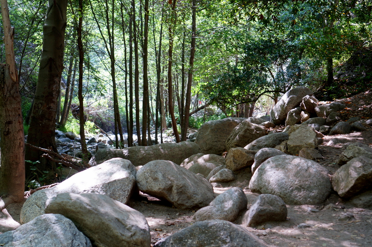
Sturtevant Falls & Hermit Falls
One of the first hikes we ever did in Los Angeles was Sturtevant Falls. This is a great hike and worth checking out.
Located in the Sierra Madre area, this 3.25 mile hike to Sturtevant Falls starts at Chantry Flats in the San Gabriel Mountains. This Angeles National Forest hike requires an Adventure Pass, so plan ahead. This hike has moderate shade as you cruise around pass old cabins heading into the canyon. For the trailhead, type in Chantry Flats in your GPS.
Millard Falls
We love Millard Falls for a quick dip into nature where the kids can explore, scramble over rocks and eventually make it to the end waterfall. This is not a long hike and is not a “workout” hike. It is a relaxing, locals type hike that is family friendly, especially those with small kids who they are trying to get used to hiking more. For anyone who wants to be a little hardcore, there is a trail that starts here at Millard Falls and goes all the way to JPL in Pasadena. It’s on our wishlist, but we need to make sure someone can pick us up at the end. Note, Millard Falls is currently only open on the weekdays. You also need an Adventure Pass to park here.
Eastside Hiking Trails in Los Angeles for Locals
 These are some of our local go to hikes that you wouldn’t necessarily take visitors on, but are great options to get out and experience a little nature, no matter where you live. As we live on the Eastside of Los Angeles, many of our favorites will be centered out here, but we also often explore the canyons of Malibu, Topanga and Santa Monica area. We would always love any recommendations you might have as well!
Beaudry Loop
One of our favorite strenuous (for us!) hiking trails in Los Angeles is the Beaudry Loop trail in Glendale. We highly recommend going up the north side and down the south for a loop. However we feel the more atmospheric side is the north, while the south does have great views over the city. Note, those looking for a workout often head up the south side which is shorter and much much steeper! The north side is a steady incline, but doable. There tends to be little to no shade on south side, and minimal on north.
Las Flores to Mt Thom
The Las Flores to Mt Thom hike is another one in Glendale starting from a local neighborhood. Parking enforcement is strict so make sure to read the signs carefully. This path begins on an abandoned concrete road and then becomes a wide fire road trail up to the top of Mt Thom. This trail is HOT when the sun is out as there is very little shade. The steady incline is less than the Beaudry Loop, but still gives a decent workout. If you have someone to pick you up, you can always combine several of the trails that all meet at the top – starting/ending in different neighborhoods. Nice views over downtown keep you company for most of the uphill trek.
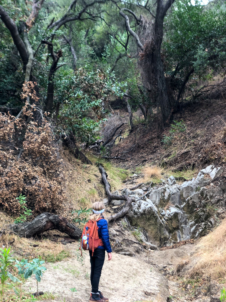
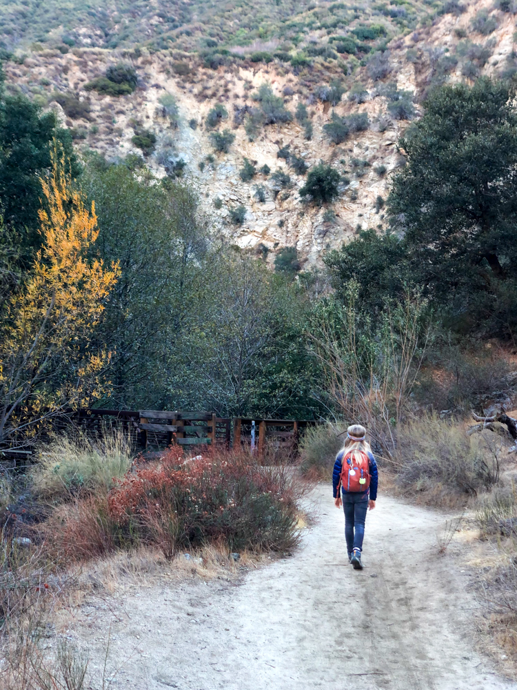
Gould Mesa Waterfall
This is one of our all time favorite hikes that can be done in a variety of ways. For years we barely made it past the immediate creek area, then we progressed another favorite of ours 8 mikes total but relatively flat along the way with only a few rises. 4 miles in/ 4 miles out to the end which is a waterfall over a dam wall. Not the most scenic waterfall, but it’s a nice ending to a really beautiful trail. The biggest caution is to watch out for bikers as they fly down the single track trail scaring you to death! This is still one of our favorite trails though. It is always a bit busy, so aim for weekdays instead of weekends.
Elysian Park Trail
The Elysian Park trail is a short, quick hike when you need a little exercise but can’t go far. This is one of many popular dog friendly trails primarily used for dog walkers and runners getting their exercise. However, it makes for a decent 2+ mile walk with gradual inclines. The views are not spectacular as it’s just over Interstate 5, but it is nice to be above the fray a bit. Parking is limited on Scott Street, however they have opened up the roadside parking as well.
 Deb’s Park
Deb’s Park is another local hike with beautiful views over downtown LA. There are a few different ways up and down depending where you park. The most traditional spot is to start at the Audubon Center. Parking is free when the center is open, otherwise there is plenty of parking on the street below. No matter which way you choose, it’s all uphill! But the view over downtown and the cute little pond is worth the effort. There is no shade on the trails, so go early or later and avoid summer days.
Hahamongna Watershed Loop Trail
The Hahamongna Watershed Loop is a great trail for both riding bikes and hiking. It’s about 4 miles total and nice and flat for most of the way. The end portion gets a little rocky for bikes, but is easy on foot. This is again a great local hike when you need to socially distance and want a little quiet time. Cruising through the watershed area across the dam and past the horse stables to end near JPL, you will see a variety of plants and animals.
Cherry Canyon
This is a great spot for locals to get out on the trails and explore. The Cherry Canyon area has a variety of trails to check out and combine together to make shorter or longer hikes. Mountain bikers love this area as well due to some steep inclines and declines. Our favorite simple trail is the Owl Trail. This trail is a shaded, narrow single track under a canopy of trees. It’s such a serene place to escape to. Our tip is to start on the fireroad, make your way to the five point intersection and then head down the small track. For some elevation gain, head up to Liz’s Loop or any of the area peaks to get some views over the mountains. Across the street from here is also Flint Canyon which weaves and winds through a neighborhood and back. This area is our go to “we don’t have much time, but need to get out” spot.
Best Hikes in Topanga & Malibu
 We love the hikes in this area of the Santa Monica mountains because of the views of the Pacific Ocean, cooler breeze and varied mountain scenery. For us, it’s worth the drive. We have a few favorites here that we are hesitant to share.
Tuna Canyon Trail
Tuna Canyon is a great hike for families. The trail can be as short or as long as you like. Here you will mostly find locals out walking their dog or catching up with a friend. While on the trail, look out for various rock labyrinth set up in the brush and on flat areas overlooking the ocean. There is also a tree fort built out of fallen sticks in the middle area of trees. Such a fun little adventure.
Topanga Lookout Trail
The Topanga Lookout Trail is a nice little trail in Topanga that ends atop a graffiti concrete platform with expansive views. This trail can be busy. Our recommendation is to go during off peak times. The trails begins at the roadside on a fireroad and then winds a bit to the left into a thinner track. There is little elevation gain making this an easy trail for most ages. I have slipped on the rock going down as it can get slippery with the loose gravel, but overall it is an easy fun hike that provides colorful photos at the top.
Backbone Trail to Sandstone Peak
Now that we have spent a great deal of time hiking and backpacking in California, we have finally set our sights on the Backbone Trail to Sandstone Peak. This 6 mile round trip hike gains around 1,100 feet of elevation. Located in the Santa Monica Mountains, this epic trail offers a view of the valley, the ocean and mountains. There are several routes to Sandstone Peak, but the Mishe Mokwa trail turns the hike into a loop. Tri-Peaks is the ultimate photo spot. Trailhead address: 12896 Yerba Buena Road, Malibu, CA 90265
Red Rock Canyon State Park
Red Rock Canyon State Park is a confusing little park in that it can be confused with Red Rock Canyon outside of LA. This way out of the way park is a good day trip adventure in Topanga though. You drive through a neighborhood ending up on a small one lane dirt track. Be cautious after heavy rains as the road will be muddy and even more uneven. Parking is $5 in the dirt lot. There is a small ranger station here if you need assistance as there is no phone service. Great rock formations to check out along the way.
Victory Trailhead Loop
This popular hike in the Upper Las Virgenes Canyon is about 5 miles and starts at a dirt fire road, with rolling hills all around you. Take a right at the first fork in the road and continue west. This can be a confusing trail, so make sure to have your AllTrails running to keep yourself on the trail! Parking is $3 in the gravel lot. Victory Blvd & Gilmore St, West Hills 91307
Grasslands Trail
Malibu Creek State Park and the national park site of the Santa Monica Mountains is one of the best places for a variety of hikes in the Malibu/Topanga areas. The Grasslands Trail is a popular trail that offers a variety of hike options once you are on it. Overall, all of the trails are relatively flat and wide. Like I said it is busy, so I would recommend avoiding on weekends if you want to social distance. We often start at the Grasslands Trail and head towards the visitor center and then end at the Rock Pool for some explorations before returning the way we came. There are multiple ways to return and to make your hike longer as well.
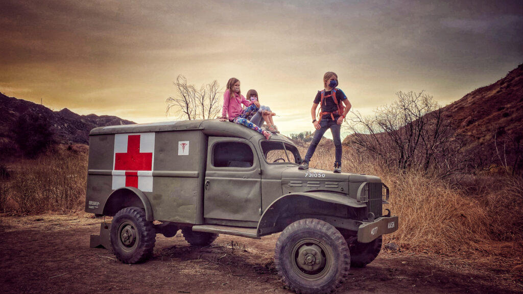 MASH Site
Adventuring around in Malibu Creek State Park is one of our favorite things to do. There are a variety of trails here offering gorgeous scenery. There are a multitude of ways to reach the MASH site from both inside the park and outside. We prefer to take the Cistern trail which a beautiful narrow trail lined with flowers in the spring. There are a ton of options here to get off the beaten path and wonder around. Be prepared to cross the river in order to reach the MASH site, so bring water shoes or hiking poles to help you along. There are often logs set up to help assist but it’s not always easy depending on the water flow.
Zuma Canyon Trail Ocean View
Zuma Canyon Ocean View Trail is just a mile or so from the Pacific Coast Highway, but feels worlds away. This moderately steep climb takes you to the top where you will have views over the highway and ocean below. 5875 Bonsall Dr., Malibu 90265
Caballero Canyon
Not quite in Malibu, but Caballero Canyon located in Tarzana is a single track 3.5 mile trail with a dry creek bed next to the trail. The scenery is nice and worth a little exploration. Walk down to flat, dusty single track with chirping birds and brush on both sides. This trail can be busy on weekends. 4040 Reseda Blvd, Tarzana 91356
Other Hikes in the Malibu area on our to do list:
- Stunt high trail – search for clay after the rains
- Garapito canyon
- Bent arrow trail
- Paramount ranch
- Calabasas peak trail
Best Hikes in Griffith Park
 For our first few years in Los Angeles, we lived in Los Feliz at the foothills of Griffith Park. This was our backyard and place we got our feet wet with hiking. Below are some of our favorites, but there are SO many that I don’t even know the names to. Start on a trail, load up your Alltrails and start walking! There is something for everyone here. Our tip – avoid the summer as none of these trails have any shade.
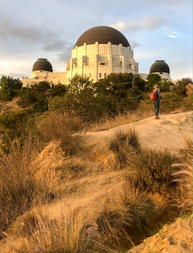
Ferndell to the Observatory Loop
One of our favorite toddler hikes was along Ferndell to the Trails Cafe. As my son got older we extended it to beyond the playground and cafe and up to the Observatory. You can make this a loop by coming down on the other side of the canyon which meets up at the playground with the other trail. Note, this is straight uphill, but worth it for a quick workout and gorgeous views of the observatory and city. Once you have reached the top, you can extend it by continuing on other trails.
Hollywood Sign Hike from Bronson Cave Canyon
After so many years of living in LA and doing many things on our LA bucket list, we finally made it up to see the Hollywood sign. Following the trail from Bronson Canyon Road, we headed up with the masses. If you only go to the base of the sign, it will be a long 6 miles and decent elevation gain, but worth it to see the Hollywood sign up close. Continue on behind the hill to get in the backside of the sign which adds another mile or two to your total as well as even more elevation gain.
Commonwealth Hike
This probably should be sorted under a locals only hike, but it’s just one of the many alternative ways up into the hills of Griffith Park. We park at the end of Commonwealth (busy during evening and mornings) and just head up the path. At the split you can stay to the left with the golf course on your left or head up the longer way to the right. We tend to go left and then come down the right path making it about a 2.5 mile loop. This trail is wide and easy to social distance and offers various ways to make it longer or shorter. Make sure to pop into the helipad for great views of the city.
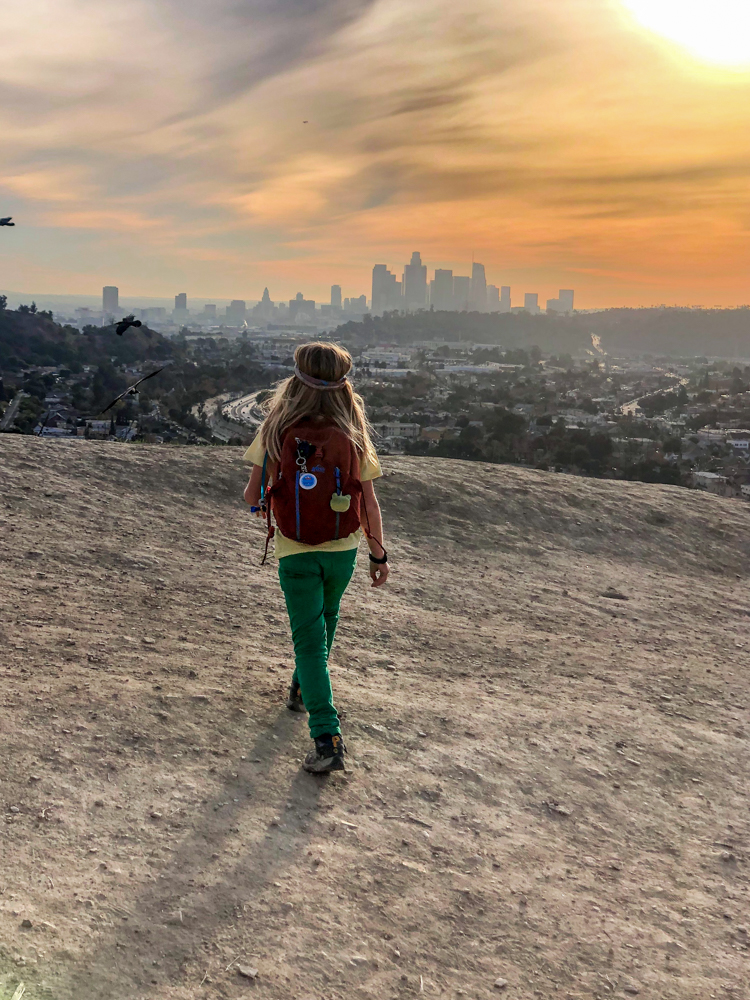
Dante’s Peak (Starting from Greek Theater Area)
Another one of our oldie, but goodie hikes that we have been doing since my son was a toddler. In days of old he would ride in his push car hopping out here and there. Now he is way ahead of me, urging me onward! The trail we take is on the road just before the Greek Theater on the same side of the road. It is dubbed the Boy Scout Trail I believe. You can park on the road by the trail or further along in the parking lot past the Greek Theater. This trail takes you up. 6 miles to the Observatory, where you then pass through the Berlin Forest and up towards Mount Hollywood. From here, you can either circle around to Mount Hollywood via Captains Roost or turn right to head straight to Dante’s View. This area is super cute and a perfect spot to journey to for a picnic.
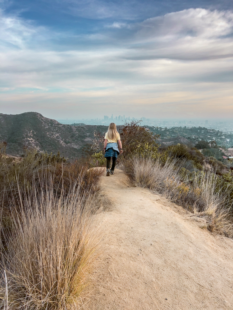
Mount Hollywood
Mount Hollywood is one of the more popular trails in Griffith Park because it starts at the Griffith Observatory. From here, you head to the end of the lot towards the Charlie Turner Trailhead sign and begin your climb north on the fire road. This is a steady climb over Griffith Park with views of the Hollywood sign and radio towers above. Along the way you will see benches and rest spots to take in the views. On your way, you will get glimpses of the Hollywood sign on the way up and the Observatory on the way down. From this trail you can venture past Dante’s View mentioned above or continue straight up to the top for amazing views often all the way out to the ocean. This trail can also be combined with the Boy Scout trail mentioned above.
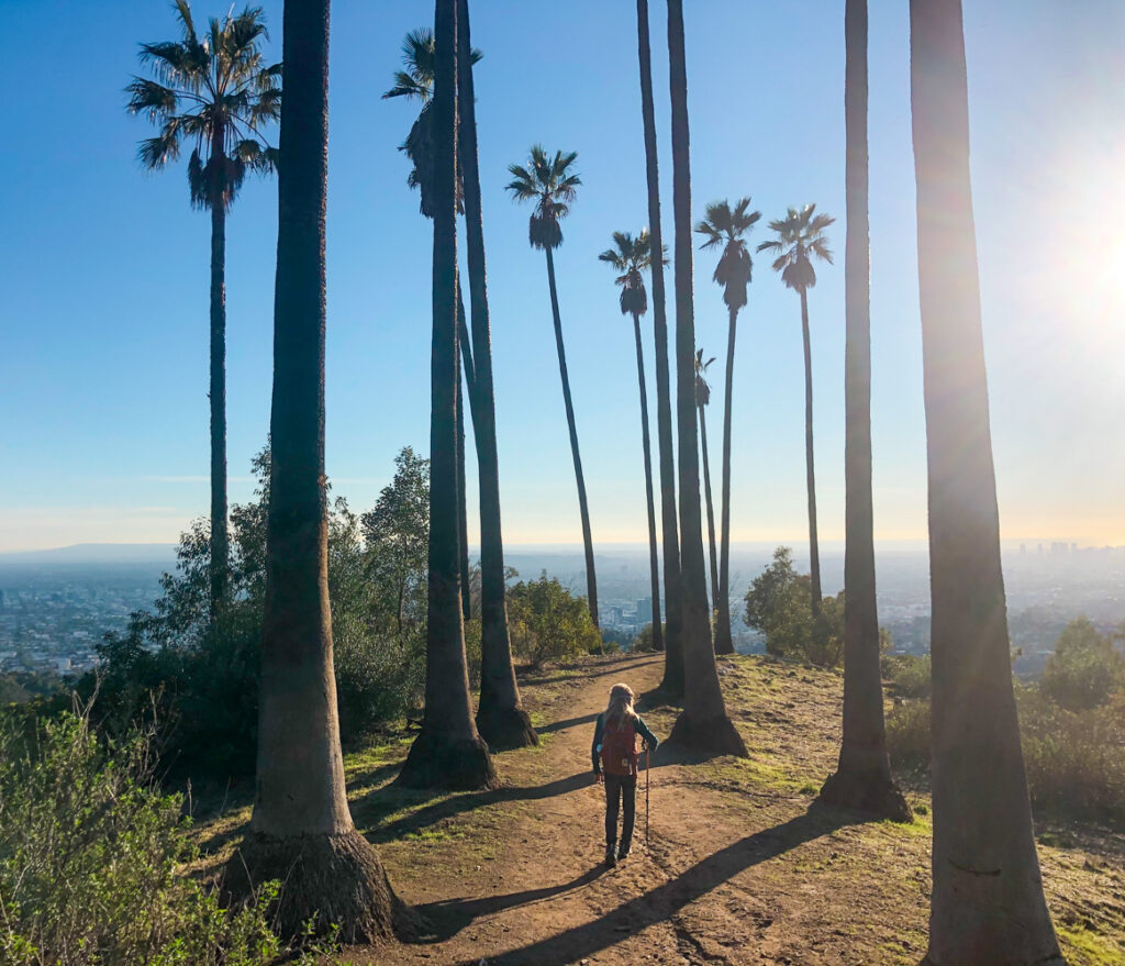
 Captain’s Roost
Have you ever noticed the collection of palm trees on the left side of the Observatory over the hill? This area is called Captain’s Roost. There are several ways to access this area, but our favorite again starts at the Boy Scout Trail down by the Greek Theater. You will then head up to the Observatory (.6 miles) and through Berlin’s Forest and to the left. This trail is a wide switchback up the mountain side before you reach the area with the palm trees. Here you will descend down stairs in a manicured garden of sorts with a few benches to relax. It’s a beautiful area, worth seeking out.
Bee Rock (Old Zoo Hike)
Back in my days of boot camp this was the hike that we often did at the crack of dawn. Now somehow I find myself doing it just for fun! Park in the Griffith Park Merry-Go-Round lot and take the road you drove in on past the white barricades. Before you reach more barricades, take a left on the third fire road to begin your 4 mile loop.
The directions sound confusing, but as long as you have your Alltrails map handy you will be fine. Follow the open fence to a pave road with the former animal enclosures – remnants of the Old LA Zoo.
Climb to a fork in a dirt road and take a right. From here you can look up and you’ll see a fenced-in lookout at the top of Bee Rock, your final destination. The part around the Old LA Zoo is one of the best hikes in LA for kids.
Best Hikes in LA – In the Angeles Forest
 Mt Lukens Fire Road
If you are looking for a moderate hike with views over Los Angeles, this is a good option. This trail is typically not very busy mostly because parking is limited. Parking is available across from the Angeles Forest Fire Station. The scary part is crossing the road with cars racing around the curves on either side! As for the trail, it is a gradual uphill climb. We have only gone about 3 miles to the teepee at the top, but the trail does head up further on the ridge.
Switzer Falls
Switzer Falls is another long time favorite of ours and often considered one of the best hikes in LA. This popular trail has two parking lots that fill up quickly. If you park at the top lot, you will add about a mile to your hike to trudge back up the concrete path to the road. Once you make it to the trail however, you will be greeted by a shaded trail following along a bubbling creek. You can also access this trail from behind JPL, making the trail around 20 miles round trip.
Hiking Near Los Angeles
 For those of you looking for a little adventure, there are tons of amazing hikes outside of Los Angeles as well. Two of our favorites right now are below. We will continue to update this as well as we find new places to share.
Piedra Blanca Trail
Piedra Blanca trail in Ojai is a beautiful trail that is great almost year round. There is water, opportunities for overnight backpack camping as well. The trail is about a 2 hour drive from Los Angeles as it’s way up into the hills, but it is worth the drive. You can make a day trip of it by stopping in Ojai or making some time for beach play as well. Park at the Piedra Blanca trailhead and head on out.
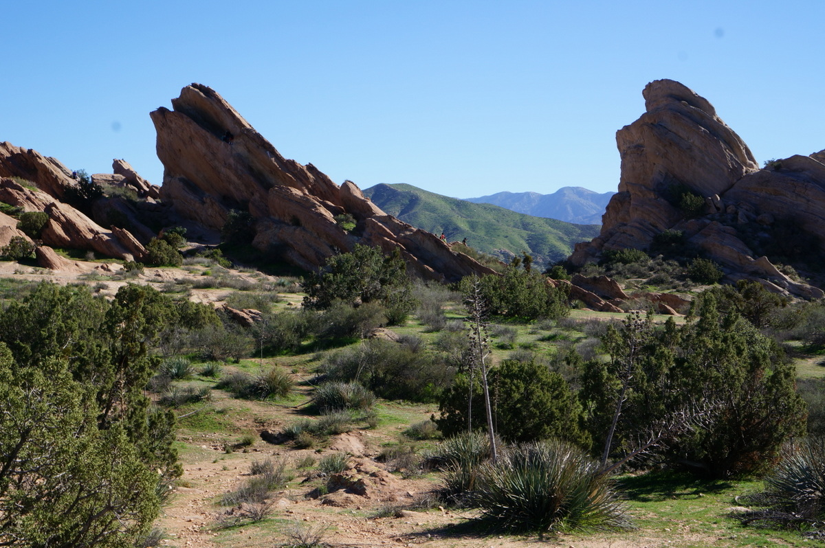
Vasquez Rocks
Vasquez Rocks is about an hour from Los Angeles and makes for a spectacular day trip with some out of this world rock scrambling and hiking around. Be aware on windy days, the rocks will be even windier! In non-COVID times there is also a small visitor center that is a hit with kids. Check out our post to read more about what to expect at Vasquez Rocks.
If You Enjoyed This Post, Sign Up To Receive Posts By Email or…
- Join us on Facebook for regular updates and related articles
- Check us out on Instagram to see what we are up to in photos
- Follow us on Twitter for links to great travel articles curated just for you
- Or share this post with others by pinning on Pinterest!